Termo do glossário: Trópico
Descrição: Os trópicos são duas linhas de latitude na Terra: o Trópico de Câncer (a 23°26′11,2″ N) e o Trópico de Capricórnio (a 23°26′11,2″ S).
A posição do Sol no céu, em relação às estrelas e a outros objetos celestes, muda ao longo do ano, percorrendo as constelações do Zodíaco. Do equinócio de março ao equinócio de setembro, o Sol está no hemisfério norte. Por volta do meio-dia local no solstício de junho, o Sol está diretamente no zênite no Trópico de Câncer. Entre o equinócio de setembro e o equinócio de março, o Sol está no hemisfério sul. Por volta do meio-dia local no solstício de dezembro, o Sol está diretamente no zênite no Trópico de Capricórnio. Durante os equinócios de março e setembro, o Sol atinge a posição diretamente acima da cabeça no equador.
A região da Terra entre os dois trópicos é frequentemente chamada de “os trópicos”. Aqui, o Sol fica diretamente acima da cabeça ao meio-dia local em dois dias por ano.
A latitude dos dois trópicos acima e abaixo do equador corresponde ao ângulo de inclinação do eixo da Terra em relação à sua órbita ao redor do Sol.
Os trópicos receberam esse nome em referência às constelações de Câncer e Capricórnio, pelas quais o Sol parecia passar durante os solstícios há dois mil anos. A precessão do eixo da Terra significa que o Sol não parece mais estar em nenhuma dessas constelações nos solstícios.
Termos relacionados:
- Equinócio
- Capricórnio
- Eclíptica
- Equador
- Latitude
- Estações do ano
- Solstício
- Círculo Polar
- Câncer
- Precessão
Ver este termo em outros idiomas
Status do termo e da definição: A definição original deste termo em inglês foi aprovada por um astrônomo(a) pesquisador(a) e um(a) professor(a) A tradução deste termo e de sua definição ainda aguarda aprovação
O Glossário Multilíngue da OAE é um projeto do Escritório da IAU de Astronomia para a Educação (OAE) em colaboração com o Escritório da IAU para Divulgação da Astronomia (OAO). Os termos e definições foram selecionados, escritos e revisados por meio de um esforço coletivo da OAE, dos Centros e Nós da OAE, dos Coordenadores Nacionais de Educação em Astronomia (NAECs) da OAE e de outros voluntários. Você pode encontrar uma lista completa dos créditos aqui. Todos os termos do glossário e suas definições são disponibilizados sob uma licença Creative Commons CC BY-4.0 e devem ser creditados à "IAU OAE".
Se você notar algum erro factual ou de tradução neste termo do glossário ou em sua definição, por favor entre em contato.
Diagramas relacionados

Latitude and Longitude
Legenda: Two views of the Earth, one viewing the Northern Hemisphere, one viewing the Southern Hemisphere. The Earth rotates around its axis, an imaginary line that runs through the Earth from the North Pole to the South Pole. The Equator is an imaginary line that is the same distant from both the North Pole and the South Pole.
The positions of two cities, Rome in the Northern Hemisphere and Sydney in the Southern Hemisphere are marked here with red dots. Arrows indicate the two spherical coordinates latitude and longitude.
Latitude marks the position north or south of the equator. Here we can see Rome has the letter N in its latitude as it is in the Northern Hemisphere and Sydney has the letter S in its latitude as it is in the Southern Hemisphere. Latitude can vary from 90° N at the North Pole to 0° at the Equator to 90° S at the South Pole.
Longitude measures the position around the equator. While the choice of the zero point for latitude as the equator seems obvious, the choice of the zero point for longitude is more subjective. By convention the zero point in longitude is the prime meridian which passes through the Royal Greenwich Observatory in the UK. This is marked here as a solid line originating at the North Pole. Longitude is measured in degrees east or west of the prime meridian. As both Rome and Sydney lie to the east of Greenwich, they have the letter E as part of their longitude. Moving west to east, longitude varies from 180° W on the other side of the world from the prime meridian to 0° on the prime meridian before reaching 180° E again on the other side of world from the prime meridian.
This diagram shows the Earth at the December solstice. Two views are presented, one viewing the Northern Hemisphere and one viewing the Southern Hemisphere about nine hours later. The shaded region shows the night side of the Earth, with the day side being lighter. As it is the December solstice, the Sun appears overhead at the Tropic of Capricorn. This is a line of constant latitude at 23°26′09.3″ S. Six months later, at the June solstice, the Sun will appear to be overhead at the Tropic of Cancer at 23°26′09.3″ N. As the Sun appears over the Tropic of Capricorn more of the Southern Hemisphere is illuminated than the Northern Hemisphere. Indeed below the Antarctic Circle (the Polar Circle around the South Pole) the Sun does not set at this time of year leading to a Polar Day. Conversely, north of the Arctic Circle (the Polar Circle around the North Pole) the Sun does not rise at this time of year, leading to a Polar Night.
Crédito: Maria Cristina Fortuna/IAU OAE
License: CC-BY-4.0 Creative Commons Attribution 4.0 International (CC BY 4.0) ícones
Atividades relacionadas
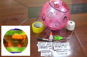
Discover Earth's climate with a balloon
astroEDU educational activity (links to astroEDU website) Description: Discover the secrets of Earth's climate zones with a hands-on experience
License: CC-BY-4.0 Creative Commons Attribution 4.0 International (CC BY 4.0) ícones
Faixas etárias:
8-10
, 10-12
Nível de ensino:
Ensino fundamental
, Básico
Áreas de aprendizagem:
Atividade divertida
, Aprendizagem por descoberta guiada
, Modelagem
, Baseado em observação
, Aprendizagem baseada em projetos
, Aprendizagem por investigação estruturada
Custos:
Baixo custo
Duração:
45 mins
Tamanho do grupo:
Grupo
Habilidades:
Fazer perguntas
, Construir explicações
, Desenvolver e usar modelos