This page describes an image Horizontal Coordinate System
Baixar arquivo ( imagem 1.76 MB)
Baixar arquivo PDF (PDF file 165.78 kB)
Also available in black and white
Baixar arquivo ( imagem 483.06 kB)
Baixar arquivo PDF (PDF file 136.70 kB)
Legenda do diagrama:
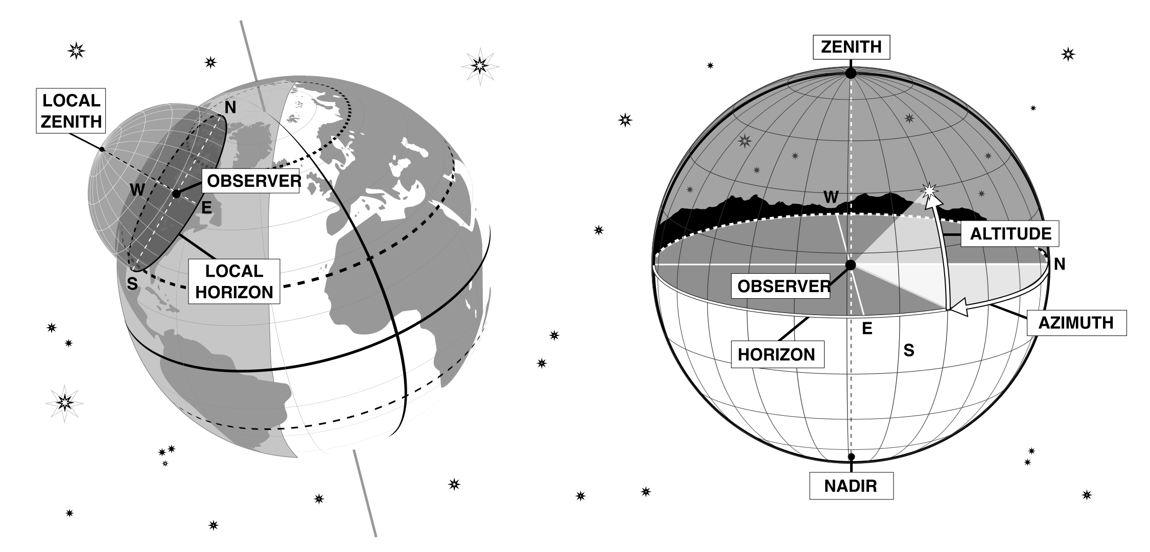
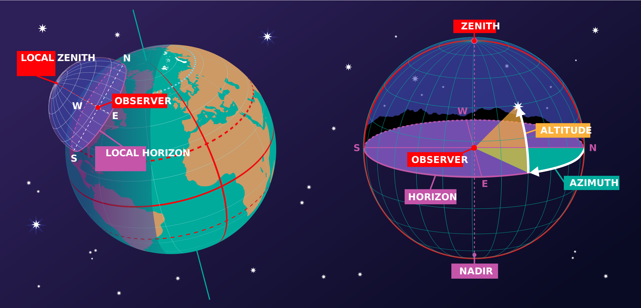
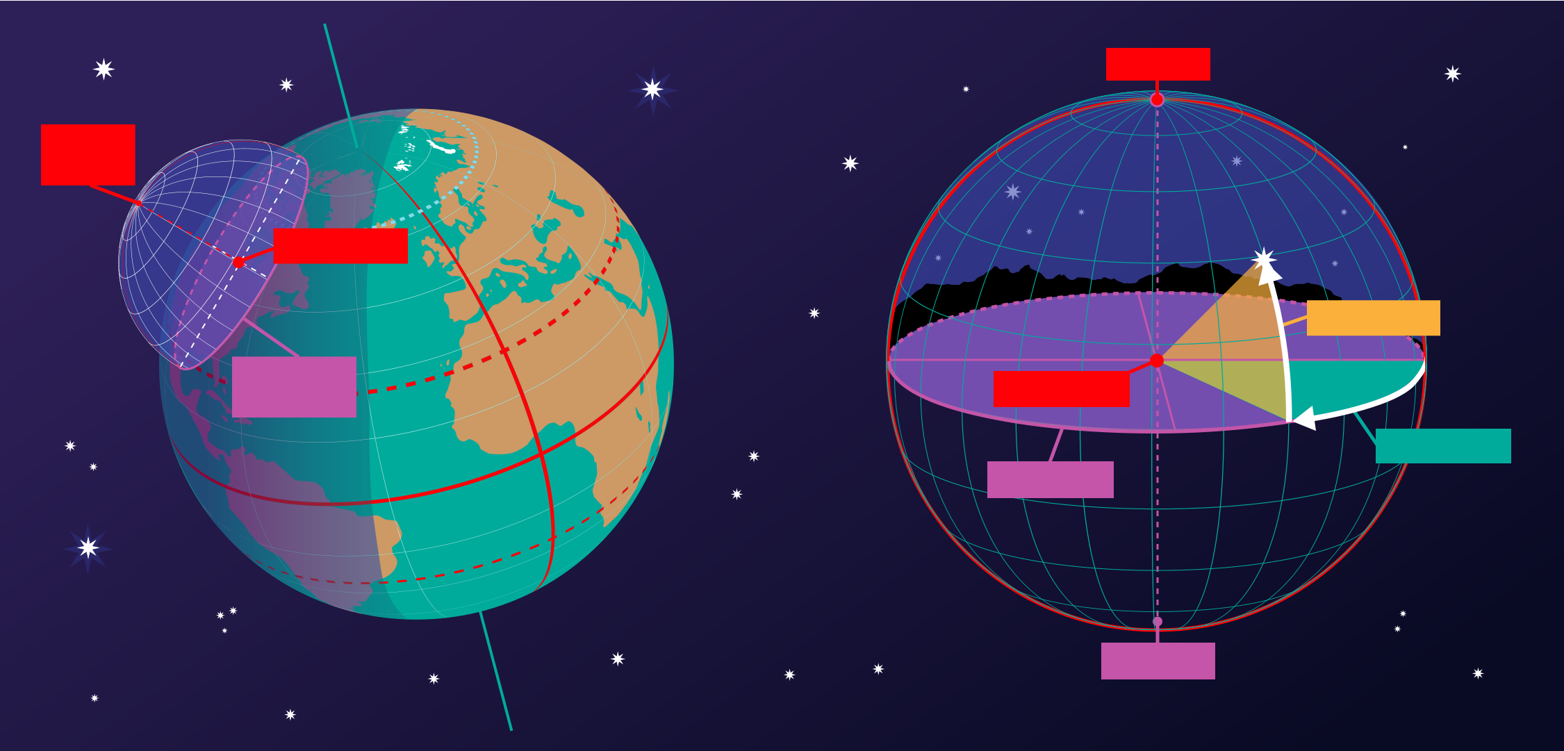
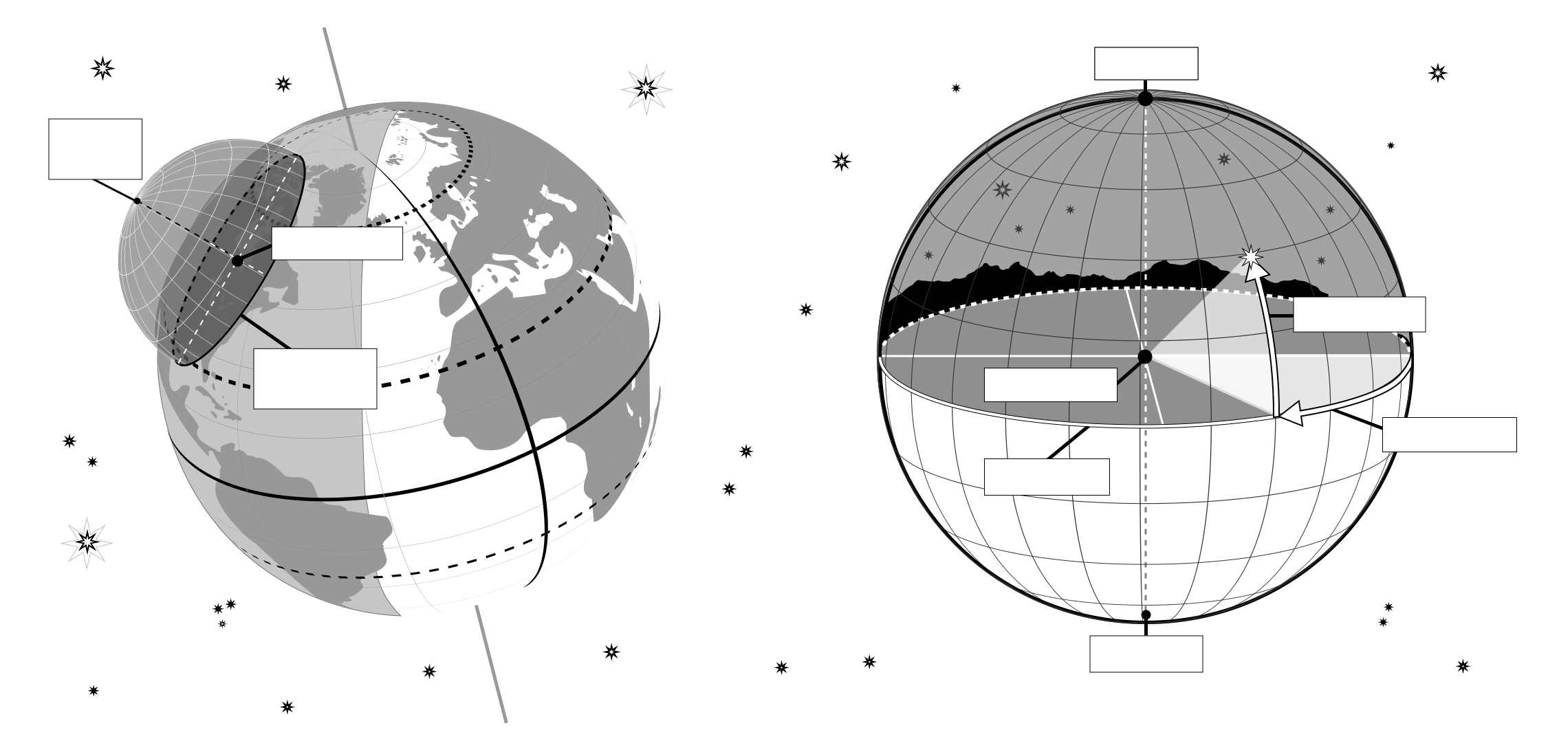
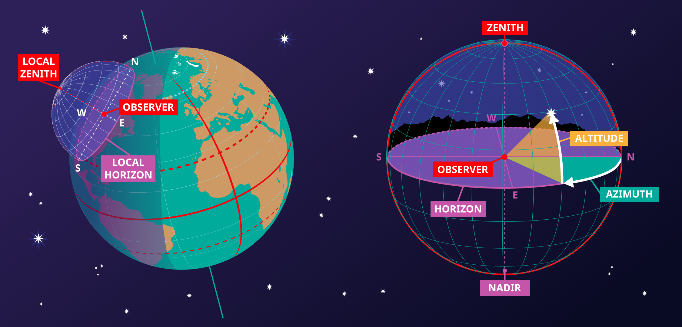
This image shows the horizontal coordinate system of an observer on Earth. On the right we see the coordinate system in the local context of the observer. The observer appears here as a point surrounded by the celestial sphere. The ground appears as a plane, while the Earth is round, we can approximate the ground in the area around the observer as a plane. The line where this plane intersects with the celestial sphere is the horizon. The point directly above the observer is the zenith, the point directly below the observer is the nadir which is hidden by the ground.
Two coordinates define this coordinate system, altitude and azimuth, hence the reason this sometimes called an alt-az coordinate system. The altitude is zero at the horizon, maximum (90°) at the zenith and minimum (-90°) at the nadir. Azimuth is the angle around the horizon. Most commonly this is defined to be zero in the direction of north. Any point on the celestial sphere can be defined by these two coordinates. However what objects appear on these position will depend on the time and the location of the observer.
On the left-hand part of the diagram, we can see that when we put the observer and their local horizontal coordinate system in a global context, that the parts of the sky the observer can see depend on their position on the Earth and on the rotation of the Earth. The zenith points perpendicular to the Earth's surface so the position on the sky the zenith and nadir correspond to is dependent on the observer's latitude. The horizon also depends on the observer's position on the Earth.
Crédito do diagrama: Maria Cristina Fortuna/IAU OAE.
Status da tradução dos diagramas: Ainda não aprovado por um revisor
Licença do diagrama: Creative Commons Atribuição 4.0 Internacional (CC BY 4.0) Creative Commons Atribuição 4.0 Internacional (CC BY 4.0) ícones
Termos relacionados do glossário:
Altitude
, Azimute
, Horizon
, Nadir
, Zênite
Categorias
Astronomia a Olho Nu
, Astronomia Observacional
Quer criar sua própria tradução ou versão deste diagrama? Então
baixe a versão SVG
deste diagrama em inglês (237.62 kB). Você pode editá-la usando
programas como o Inkscape (gratuito) ou o Adobe Illustrator
(proprietário). Apenas lembre-se de creditar adequadamente o autor do original.
Also available in black and white ( imagem 237.62 kB).
Você também pode criar sua própria versão ou tradução deste diagrama adicionando texto a uma versão
deste diagrama sem texto. Basta baixar um dos arquivos abaixo:
Baixar arquivo sem texto ( imagem 578.50 kB)
Baixar arquivo PDF sem texto (arquivo PDF 175.90 kB)
Also available in black and white:
Baixar arquivo sem texto ( imagem 450.79 kB)
Baixar arquivo PDF sem texto (arquivo PDF 141.72 kB)
As legendas dos diagramas apresentadas no site da OAE foram escritas, traduzidas e revisadas por meio de um esforço coletivo da OAE, dos Centros e Nós da OAE, dos Coordenadores Nacionais de Educação em Astronomia (NAECs) da OAE e de outros voluntários. Você pode encontrar a lista completa de créditos do nosso projeto de tradução aqui. Todas as legendas de arquivos de mídia são publicadas sob uma licença Creative Commons CC BY-4.0 e devem ser creditadas à "IAU OAE". Os próprios arquivos de mídia podem ter licenças diferentes (veja acima) e devem ser creditados conforme indicado acima em "crédito".
Se você notar algum erro neste diagrama ou em sua legenda, por favor entre em contato.