Glossary term: Navigation
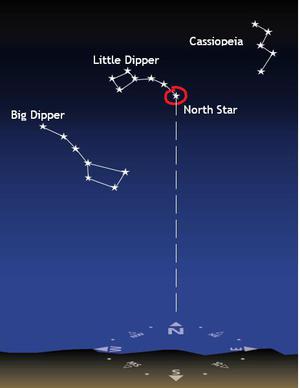
Description: Navigation is the process of finding out where on Earth or where in space you are, your intended direction of travel, and how to get to where you want to go. Historically, the Sun and stars played an important role in navigation. At the simplest level, in a clear night in the northern hemisphere you can use the North Star to determine where north is and choose your direction of travel accordingly. In the southern hemisphere the Southern Cross points towards south. Prior to the development of modern navigational equipment, "celestial navigation" was essential for navigation. Navigators would determine the angle of the Sun above the horizon at noon to deduce their latitude, and the comparison of the time of local noon (highest sky position of the Sun) with a clock showing Greenwich Mean Time to determine their longitude. Modern navigation mostly relies on signals from GPS and similar satellite systems.
Related Terms:
See this term in other languages
Term and definition status: This term and its definition have been approved by a research astronomer and a teacher
The OAE Multilingual Glossary is a project of the IAU Office of Astronomy for Education (OAE) in collaboration with the IAU Office of Astronomy Outreach (OAO). The terms and definitions were chosen, written and reviewed by a collective effort from the OAE, the OAE Centers and Nodes, the OAE National Astronomy Education Coordinators (NAECs) and other volunteers. You can find a full list of credits here. All glossary terms and their definitions are released under a Creative Commons CC BY-4.0 license and should be credited to "IAU OAE".
If you notice a factual error in this glossary definition then please get in touch.
In Other Languages
- Arabic: الملاحة
- German: Navigation
- Spanish: Navegación
- French: Navigation
- Italian: Navigazione
- Nepali: नेभिगेसन / दिशानिर्देशन
- Brazilian Portuguese: Navegação
- Simplified Chinese: 导航
- Traditional Chinese: 導航
Related Media
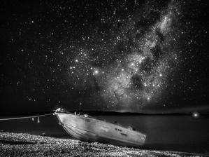
Sailing the Celestial Seas
Caption: Honorable mention in the 2023 IAU OAE Astrophotography Contest, category of Still images taken exclusively with smartphones/mobile devices.
In this black and white snapshot taken in April 2022 with a smartphone, a solitary boat rests on the shores of Lake Eucumbene, Australia, framed by the brilliant display of stars comprising the Milky Way. The prominent glow of the galactic centre stands out against the night sky, its intricate patterns of stars and nebulae casting a striking contrast. Each shimmering dot represents a distant sun, possibly orbited by uncharted planets, underscoring the vastness and complexity of our sprawling home galaxy.
Credit: Lucy Yunxi Hu/IAU OAE (CC BY 4.0)
License: CC-BY-4.0 Creative Commons Attribution 4.0 International (CC BY 4.0) icons
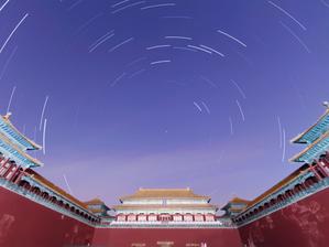
Star Trails of the Forbidden City
Caption: Honorable mention in the 2023 IAU OAE Astrophotography Contest, category of Still images taken exclusively with smartphones/mobile devices.
Beneath the celestial ballet of star trails that weave their way across the night sky, the Beijing Forbidden City stands as a testament to ancient celestial connections in this image captured in March 2022. Designed with a cosmic alignment in mind, the palace echoes the orientation of the North Star, also known as Polaris, a celestial anchor that has long guided navigators and symbolised steadiness in the sky. It was believed that the Emperor embodied the earthly representation of this pole star, bridging the realms between heaven and earth. In this harmonious one-hour exposure captured with a smartphone, the streaks of stars trace their nightly journey across the firmament, converging toward the North Star, reflecting the precision of both architectural design and celestial paths.
Credit: Stephanie Ziyi Ye/IAU OAE (CC BY 4.0)
License: CC-BY-4.0 Creative Commons Attribution 4.0 International (CC BY 4.0) icons
Related Activities
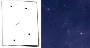
What is a Constellation?
astroEDU educational activity (links to astroEDU website) Description: Investigate three dimensional objects and perspective using constellations
License: CC-BY-4.0 Creative Commons Attribution 4.0 International (CC BY 4.0) icons
Tags:
Hands-on
Age Ranges:
6-8
, 8-10
Education Level:
Primary
Areas of Learning:
Modelling
, Structured-inquiry learning
Costs:
Medium Cost
Duration:
1 hour 30 mins
Group Size:
Group
Skills:
Analysing and interpreting data
, Asking questions
, Constructing explanations
, Developing and using models
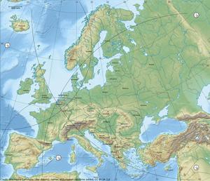
How To Travel on Earth Without Getting Lost
astroEDU educational activity (links to astroEDU website) Description: Use a globe to describe your position on Earth.
License: CC-BY-4.0 Creative Commons Attribution 4.0 International (CC BY 4.0) icons
Tags:
Geography
, Maps
, GPS
, Celestial navigation
Age Ranges:
8-10
, 10-12
, 12-14
Education Level:
Middle School
, Primary
Areas of Learning:
Structured-inquiry learning
Costs:
Low Cost
Duration:
1 hour
Group Size:
Group
Skills:
Analysing and interpreting data
, Developing and using models
, Using mathematics and computational thinking
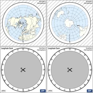
The Quest for Longitude
astroEDU educational activity (links to astroEDU website) Description: How to navigate at sea like an explorer?
License: CC-BY-4.0 Creative Commons Attribution 4.0 International (CC BY 4.0) icons
Tags:
Clocks
, Geography
, Coordinates
, Celestial navigation
, James Cook
, Exploration
Age Ranges:
14-16
, 16-19
Education Level:
Middle School
, Secondary
Areas of Learning:
Discussion Groups
, Modelling
, Structured-inquiry learning
Costs:
Low Cost
Duration:
2 hours
Group Size:
Group
Skills:
Analysing and interpreting data
, Asking questions
, Communicating information
, Developing and using models
, Planning and carrying out investigations
, Using mathematics and computational thinking
Where on Earth am I?
astroEDU educational activity (links to astroEDU website) Description: How do satellite-based positioning and GPS navigation work?
License: CC-BY-4.0 Creative Commons Attribution 4.0 International (CC BY 4.0) icons
Tags:
Clocks
, Geography
, Maps
, GPS
, Countries
, Speed of light
, Galileo
Age Ranges:
14-16
Education Level:
Middle School
Areas of Learning:
Guided-discovery learning
, Problem-solving
Costs:
Low Cost
Duration:
1 hour 30 mins
Group Size:
Group
Skills:
Analysing and interpreting data
, Asking questions
, Communicating information
, Constructing explanations
, Developing and using models
, Using mathematics and computational thinking
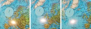
Navigate like a Viking – Use the Sun, not your phone!
astroEDU educational activity (links to astroEDU website) Description: Learn how the Vikings used the sky to navigate at sea with a hands-on activity!
License: CC-BY-4.0 Creative Commons Attribution 4.0 International (CC BY 4.0) icons
Tags:
History
, Geography
, Maps
, Coordinates
, Celestial navigation
Age Ranges:
12-14
, 14-16
Education Level:
Middle School
Areas of Learning:
Discussion Groups
, Modelling
, Structured-inquiry learning
Costs:
Medium Cost
Duration:
1 hour 30 mins
Group Size:
Group
Skills:
Analysing and interpreting data
, Asking questions
, Communicating information
, Developing and using models
, Planning and carrying out investigations
, Using mathematics and computational thinking

